
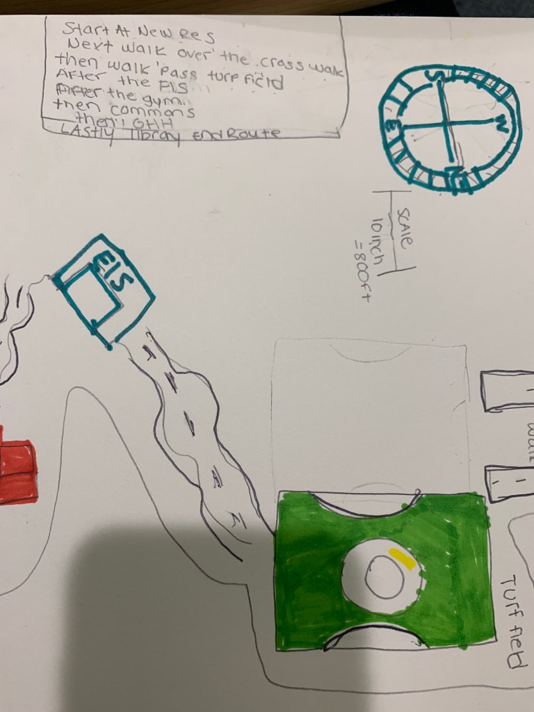
Traveling to the library is a routine task for many college students, as it is a quiet place to focus on studies. There are many routes that can be taken to get there and oftentimes time is limited; students need to follow a course that is direct. In doing so, many students follow the same route day in and day out not noticing their surroundings, as they are on a mission to get from one place to the next. In examining the route that I often travel, what stood out to me is the intersection in front of New Res. Here there are many cars driving past, so it’s important to be careful when walking from one building to the next. My goal when attending to my travels to the library was to inform people of the route I follow to go to the library and how I get back to New Res in South Campus. I first start in New Res and walk over the crosswalk. Then, I walk past the turf field, by ELS and then the gym. Next, I walk past Commons and GHH and finally walk to my last destination, the library. The map I drew includes arrows and crude representations of landmark buildings, which naturally stimulates my brain and move my eyes from one destination to the next. The curvature of the lines on the map flow and help me to travel forward. I encountered a bit of a problem on this project drawing the compass rose on the piece of paper. It was difficult for me because I had to draw it exactly the same each time, and I had to figure out which direction I was going towards. The color of my map is just how I see my representation of the buildings; I had a limited amount of colors to use to illustrate my map. The turf field is green and the buildings are yellow. While the gym is actually brown, I only had an orange marker, so that is how I had to create this visual representation of the color of the buildings. That said, I am satisfied with how it turned out. Referring back to the readings helped me see the difference between the buildings. I didn’t realize how many places I pass by everyday and how many steps I actually walk to and from my apartment to the library; this was an AHA Moment! I also realized how far away New Res is. This experience reminded me of how the professor showed us a visual representation in class of a game and how the person was a far distance from the other person and how they could not find their way to get to the same place. It is hard to give exact directions of the route that you take on a regular basis because the route you travel is so automatic that you do not think about where you are. In reflection, it is important to include landmarks so that others have a sense of direction and idea of where they are in relation to what is on a map. If I had more time to draw the map I would write out longer, more detailed directions and perhaps possibly draw more specific parts of campus. I wish that I could have added more buildings to my map representation and perhaps more color so you could discern the differences of the buildings by color; in addition, having key code, so that the color matches the boxes, would also help others to identify each building.
